Starting at Edgewood Rd in Southington and ending at Wooster St in New Britain ~ 14.2 miles 7 hrs with breaks.
Picking up at Edgewood Rd again, the first 30 minutes of the trail was walking on the road. Just past a golf course on our left there were two signs welcoming us to the woods- where we stayed for about an hour. I believe this section was Short Mountain. It was an easy hike except a few rocky down hill areas. The ground coverage of wet leaves made it a little trickier than need be. There were some cool cedars that reminded me how much I love that tree. About an hour later we came to another street but quickly were back into the woods and from here the trail is a bit more adventurous.
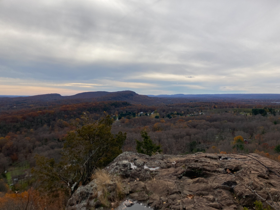
The trail is wooded and quickly went up hill here to bring us to the cliff base of Ragged Mountain. We saw some rock climbers here and followed the path to the crevice that we had to climb. At first it looked pretty easy because the rocks are conveniently spaced like stair steps, but we did have leaves and wet rock to contend with. There is one awkward part that requires your full body to pass. We had to pull ourselves up and onto a “little shelf” and then pull up from there and of course this is where the sides of the rock were very wet. Once on top, we were greeted with the beautiful views of Ragged Mountain.
The blue trail continues across the top of Ragged Mountain and proceeds to go up and down, and up and down, and through some tricky areas. Coming down the other side of Ragged, we saw some more rock climbers. Be careful here as their ropes run across the hiking trail and could easily launch someone down the cliff. Also there is a warning sign on the bottom warning people hiking up that this is a dangerous area, but no sign at the top for those of us hiking down. So just know it is a dangerous area.
Once down from there, we came to another road portion that walked us around an orchard and part of Shuttle Meadow Reservoir. We were on the road for 12 or so minutes and then back to the woods. The start of woods was covered in euonymus and these plants were a brilliant shade of pink. The trail continues to go up and down, and up and down, and up and down. I know we went a long distance but the downhill parts were really starting to hurt my knees.
As we were on the final section of trail it got a little gushy and there were a lot of downed trees, including white birches (eek). We overshot sundown by 30 mins so we did leave the woods in the dark, but fortunately didn’t need lights until we reached the road back to the car.
This hike had great views, excellent rock formations, lots of water: Hart Pond, Wassel, Shuttle Meadow, and Plainville Reservoir, and cool plants along the way including: common winterberry, euonymus, and barberry.
Overall I would agree that the trail is “easy with difficult areas,” but there are many spots along the way that I would definitely recommend waiting for a dry day to do. The trail runs on the edge of some steep areas and in several places required feet and hands to ensure safety.


Adventurers included: Jes, Dana, Bryan & Dogo