The trailhead starts at 437 West Lane in Berlin, CT. There are several trials, but we did the Blue/Red to Blue to Blue/Orange for a nice loop that totals ~ 5.3 miles.
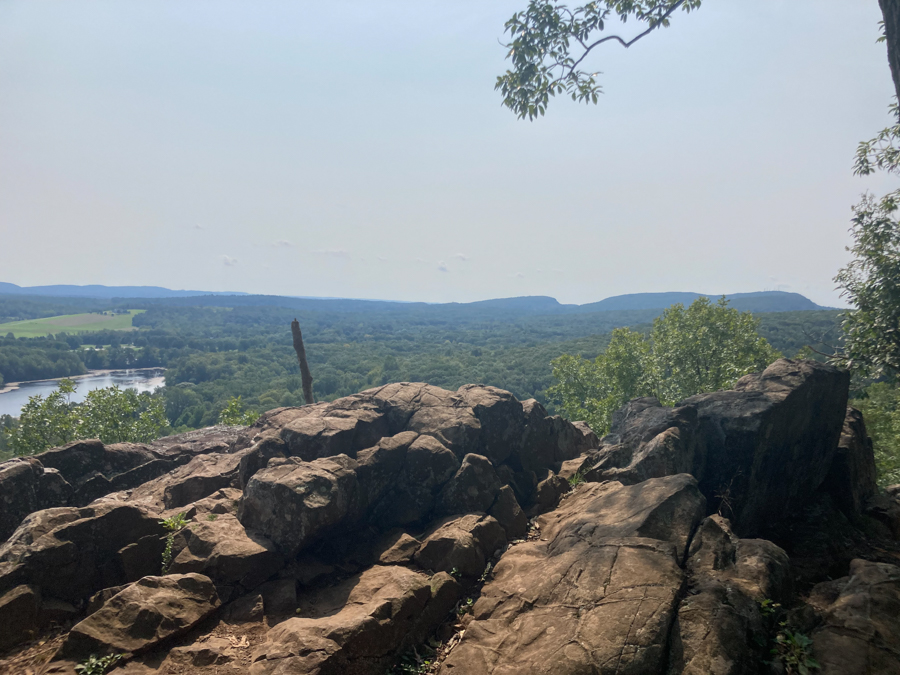
Ragged Mountain is another popular hiking spot in Connecticut. I have done some trails here twice before, and will be going back to it soon since a section of the Metacomet goes through this area. The area is a mix of traprock and woods. The trail itself takes you through dirt, to loose rock, to ledges and a few rocky scrambles. It is probably a moderate climb, not because of steep inclines, but because of the rockiness. It offers beautiful views of several bodies of water. I believe what we saw was the Wassel Reservoir, South Wassel Reservoir and Hart Pond.
Today was my first hike with Elahe (Ellie) and we decided this would be a good place to start. I intentionally picked a hike that would be roughly 3.7 miles (according to map), but of course ended up at 5.3 when we were done. Regardless of the longer distance we had a great time.
This trail is pretty well taken care of. There was some litter, broken glass in a few spots, and a random bra at one of the lookout points, but that is because people are trashy not because the trail wasn’t well groomed. (Carry out what you carry in people!) That said, there are a few fallen trees on the trail and I have lost the blue/red trail, three times now, at about the same spot. I end up in a ravine and have to climb loose basalt rocks to get back on trail. Not upset just confused. Getting “lost” today paid off since Ellie found a snail on a mushroom and captured “an award-winning photo!”
Speaking of mushrooms, there were some cool mushrooms throughout the entire trail. Most notable was a little red one. Ellie had never seen a red mushroom before and it was great to see her enthusiasm. I of course took a picture of her taking a picture of it.
We followed Blue/Red to most of the lookouts but it switches to Blue (Metacomet Trail) at the summit for a bit. This section passes through some of the craggier parts off the trail and requires you to use your full body in some areas.
Follow Blue back into the woods and eventually you’ll have options to hop on Blue/Yellow, Blue Orange or Blue Red to continue a loop. We chose Blue/Orange for today. Before you get to these options, there is a trail map hanging way up in the tree. Someone with a sense of humor, or a giant, must have hung it. It is about 8 feet high and there is a small rock on the ground for you to stand on for a better view. I am 6 ft and on the rock still can’t read the sign.


Adventurers included: Jes, Elahe & Jasper