Starting at 2865 Albany Ave, West Hartford and ending at M.K. Wilcox Park 96-98 Wintonbury Rd, Bloomfield, CT ~ 10 miles and 5 hours.
We woke up Christmas eve morning to snow! It wasn’t enough to change our hike and Dana and I were both excited to try out our new winter boots. Jenny and DeVonte were joining us and it was his first time hiking in snow. We had Jenny and DeVonte drop their car at Talcott Mountain State Park on rte 185, so they could leave early and not be committed to a ten mile hike. (They ended up doing six miles.)
Fortunately the section from Albany Ave to the Heublein Tower and down to Jenny’s car was an easy section of trail. It starts off as a basically flat trail next to Hartford Reservoir number six. We followed that for maybe 1.6 miles before heading into the woods and going up. It was a gentle climb up King Philip’s Mountain. If memory serves me correctly, we only had one part that was a little bit of a scramble due to the snow. Unlike other sections of the Metacomet, we were fortunately not on the edge of the ridge. Even though the park is called Talcott Mountain Park, the blue trail doesn’t actually go up Talcott Mountain which is about a mile away and goes up King Phillip Mountain which is where Heublein Tower is.
Talcott Mountain Park is a heavily trafficked park in CT, but because of the holiday and snow, we did not have to deal with people. The Tower was closed and we didn’t do as much exploring as we would if there wasn’t snow, so I will definitely go back on a sunny day. I think there is also a cave that we missed.
We took in the views from the pavilion, the grounds around the tower and the surrounding peak. On a clearer day the views are probably far, but today they were grayed out quite a bit, but still pretty.
We climbed back down to rte 185 and parted with Jenny & DeVonte. We crossed the road and I believe this was the start of Penwood Park, and the trail instantly went up. It was a little comical to me because I was expecting King Philip Mtn. to be more difficult than the unnamed (on the map) hill next to it. It wasn’t a hard climb, but it was a climb. On the other side of the hill, there is a cute little lake called Lake Louise.
From there we walked past another hill on the right that was covered in rounded rocks. I made a comment about how I don’t want to climb that ever before I realized the trail was naturally going to loop us up it — but fortunately not in the loose rubble area. Before turning right up the hill there is a weird round concrete structure on the ground. I tried looking up what it is but haven’t found an answer yet.
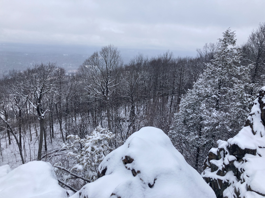
As we continued to climb we came to an area where there are rock stairs which were pretty convenient and bring you to the top. The top is referred to as “The Pinnacle.” It offers great views and we were able to look over and see the tower and where we had just climbed from.
The climb down was a little more difficult on this hill than any of the previous ones, but it was still easy. We did note on one of the downhill sections you could see a biker either hit a tree or just barely missed it. Being close to the airport, you can hear and see planes as they fly overhead. The trail lead us right back to our car and we’ll start here next time.
The snow added a layer of peace and tranquility to the entire hike. The gray skies overshadowed our views, but it was still a fantastic hike. I will definitely come back to explore both parks more on sunny clear days.


Adventurers included: Jes, Dana, Bryan, Jenny & DeVonte