Starting at 246-290 Wintechog Hill Rd, North Stonington and ending at Legend Wood Road North Stonigton, CT ~ 13.35 miles and 6.5 hrs
What to say about the Narragansett Trail? Part of me wants to warn people to avoid this trail, another part thinks it was worth it because overall it is a pretty trail, but I may have just been enjoying the day with my hiking companions more than the trail itself.
First, getting there and dropping cars was not easy. The gps coordinates from the CFPA map actually lead into the Pachaug Forest down a long dirt road. It probably does connect to the parking spot, however approximately 2 miles away from the destination, there is a nice yellow gate across the road. We rerouted by putting Johnson Rd, North Stonington into gps because it connects to the right end of Legend Wood Road and found the parking.
We headed over to Wintechog Hill Road to start the hike, knowing that between Lantern Hill and Wintechog Hill we would encounter a trail closure. I had read a few peoples posts that mentioned how they got around, and we saw there was a Jeep Trail on the map that looked like a potential route, so we decided to just wing it and go for an adventure.
Unfortunately, we had a rocky start. Going up the first major hill there was an incident with an overly excited and off leash dog and his irresponsible owner, and then we got turned around. Just after the first major hill, the path goes straight for a little and then forks. There are blue markers to the left and on the right that lead to a lookout where you can see the casino. On the right there were multiple blazes, so we took that path— wrong! It looped us back to the beginning. So take two!
Up the hill again, this time without an incident! We followed the trail to the left. Shortly after that I encountered a snake. (Yup, it’s that time of year again!) Between the parking, the poor signs, the dog, the snake, and knowing that we were about to deal with the trail closure I was tempted to call it a day, but I am glad that I pushed through.
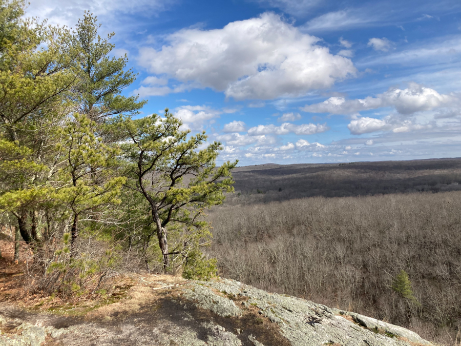
The trail curves around and comes to a better lookout point (sans casino) and then wraps back into the woods. The terrain is mixed and there are lots of awesome quartz rocks here. If I am not mistaken, most of Lantern Hill is quartz. There is one section of trail that you squeeze down a split boulder. It isn’t difficult but because it was wet, it was a little slippery.
The trail continues to the woods and goes through some Mountain Laurel. This is where I saw my first butterfly of the year at 11:30AM right before the Spring Equinox at 11:33 AM.
The trail leads to a transfer station for a brief road walk. The trail picks up on the right hand side to go back into woods and that is where the first trail closure sign was. We headed in any way since we didn’t seem too far from the Jeep Trail. We followed the blue trail until we came to the electric fence. At this point we followed parallel paths in a field and went through quite a few prickers. Eventually we met up with the blue trail again and carried on our way. Unfortunately we did have to jump a fence onto private property to get to route 2. The trail crosses route 2 and goes through a small neighborhood before returning to the woods.
From here to the end at Legend Wood Road the trail is very peaceful. The Yawbucs Brook is next to the trail for a good portion and there were some water ways to cross. There was a great beaver pond where we got to hear some very active peepers.
There are a ton of wonderful rock formations on this trail and a good amount of hills. The hills aren’t overly high or steep, but after 10+ miles they were a little more effort. We will pick up the final few miles in two weeks to finish but I think this trail will also go down as a one and done for me.


Adventurers included: Jes, Mike, Dana, Bryan & Dogo